Manaslu Base Camp Trek Detailed Information
Discover the detailed day-by-day itinerary for the Manaslu Base Camp trek. Explore stunning landscapes, traditional villages, and high mountain passes with essential tips to plan your adventure in Nepal's remote Manaslu region.
Overview of the trek
The Manaslu Circuit Trek is a classic off-the-beaten-path trail in Nepal. The trek is executed along the border between Nepal and Tibet. This trek is one of the favorite and most popular trek ever since it was opened in 1992. It provides an amazing journey around the 8,163-meter-high Mount Manaslu, the eighth-highest peak in the world.
The Manaslu Circuit Trek offers a more peaceful experience as compared to the well-known trails at Everest Base Camp (EBC) and Annapurna Base Camp(ABC). It still has its natural charm and is less crowded.
The trekking journey begins in Kathmandu. We take a Jeep drive to Maccha Khola. This is the starting point of the trek. From this point the trekking route leads to Jagat, Deng, and Namrung in order to reach Samagaon.
One day is reserved for acclimatization at Samagaon. We head towards Samdo and Dharmashala. Dharmashala is the highest trekking point. The trek leads to Bhimtang, Gho, and eventually Dharapani where we catch a jeep back to Kathmandu.
Manaslu Circuit Base Camp Summary
Duration: 13 Days
Starting Point :Machha Khola.
Ending Point: Tijle.
Maximum Elevation: Larkya Pass ( 5,106 meters )
Ideal Seasons: June - Beginning of January
Accommodation: Tea house, lodges and guest room
Permits requirements : Restricted Area Permit ( RAP), Manaslu Conservation Area Permit ( MCAP) and the TIMS .
Manaslu Circuit Major Attraction
- Trek close to Manaslu Base Camp, the eighth-highest peak in the world.
- There is a considerably less overcrowded trail in Mansiri Himal's region.
- The drive to Arughat/Machha Khola from Kathmandu is quick but incredibly gorgeous.
- Panoramic views of numerous massive Himalayas, including Annapurna II, Manaslu, and Lamjung Himal.
- Go through the Gorge of Budi Gandaki.
- Might witness the unique wildlife and plants, such as snow leopards.
- Discover the fascinating local traditions while touring the more than 200-year-old monastery.
- Trek from Samdo Village to the Tibetan border.
Why Alpinist Club?
- Free private transportation pickup and drop-off at the airport.
- Experts from the area (all of the trek leaders who oversaw the journey to Manaslu Circuit were native to the Manaslu region).
- Following booking confirmation, an online tour briefing will be conducted if necessary. Before you leave, the Alpinist Club will give you a thorough briefing on the Manaslu hike.
- 100% fixed departure is assured.
- 24/7 phone support: +977 9767482155 for local, and international calls and WhatsApp.
- Simple payment method.
Transportation details
Two options are available :
Private jeep / Hiace
You will travel in the greatest comfort if you pick private jeeps. The main benefit of traveling in a private jeep is that you don't have to start the trip in a rush.
Throughout the journey, you are free to stop wherever you choose and eat lunch wherever you like. Along the trip, you can stop at a few significant intersections and take pictures.
It will take six to seven hours in the private jeeps if the route is in good shape, but this still depends on the road.
Local Bus
You must arrive at the office by 7 AM if you would like to take a local bus to Manaslu as part of our package. A private cab will drop you off at the office, and you will then start your bus ride to Machha Khola for the Manaslu Circuit Trek at the Buspark.
Private jeeps provide a higher degree of comfort than the local bus. Taking a local bus will take you approximately nine to ten hours.
We advise you to travel in a private jeep for greater comfort and independence. Additionally, our guide will accompany you in a bus or private jeep.
Itinerary Details
Day 1: Kathmandu to Machha Khola (869 m) through Solti Khola
Day summary
Route -Kathmandu → Naubise → Maklekhu → Dhading Besi → Jyamire → Gola Bhanjyang Aarughat → Soti Khola → Machha Khola
Beginning Point: Kathmandu (1400 m/ 4600 ft)
Ending Point: Maccha Khola (869 m/ 2851 ft)
Lunch: Jyamire
Kathmandu to Machha Khola Distance: 160 km (100 miles)
Total Descent: 539 m/ 1768 ft
Overnight: Machha Khola
Meal: Lunch and Dinner
Accommodation: Tea House
Walking / Driving: 7-8 hours driving
Tea House Information
Number of tea houses: 10+ a few guest houses
Toilet attached: Available
Wi-Fi: Available
Charing in the room: Available
Day 1 Major Attraction
- Travel along the river.
- Clear Days offers a view of the Terrance farm's flora and agricultural land, including Manaslu and Ganesh Himal.
- Hindu Temples
Day Activity Details
Our journey begins from Kathmandu after having breakfast at 7: 00 AM. All the team members will meet up and depart at 7: 30 AM. The drive takes us from Thankot to Dhading covering approximately 90 km. We stop at Jyamire for lunch at 11:00 Am. We continue our journey from Dhading Besi to Arughat till 2:00 P.M. We will continue our journey towards Maccha Khola. We arrive there around 4: 00 P.M
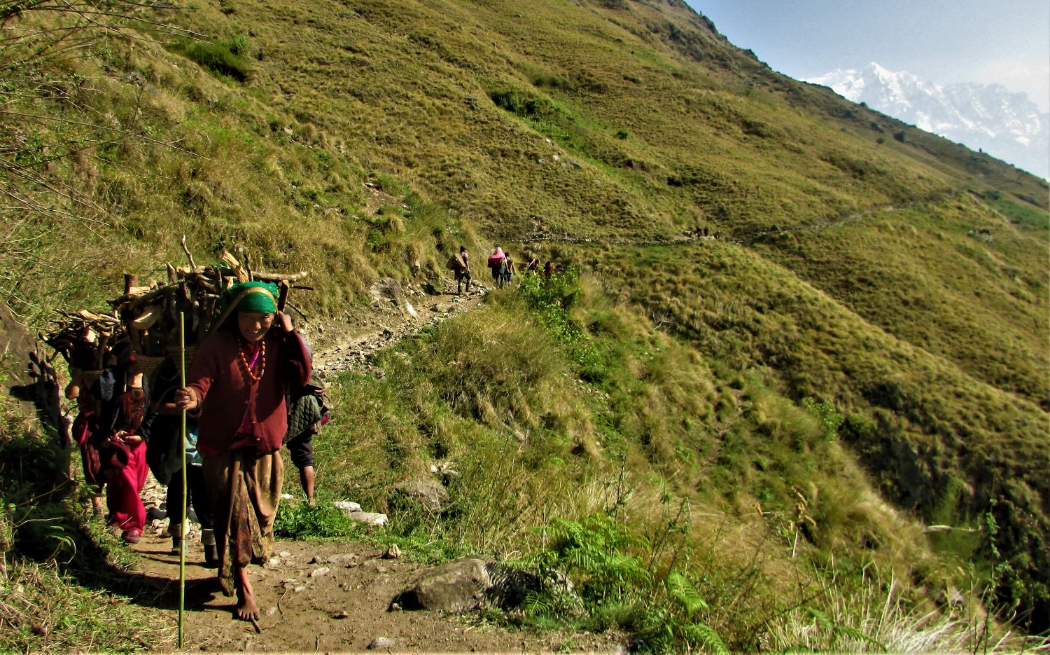
Maachakhola
The first place we go to sleep at night in Nepalese communities is Machha Khola. The Gurung people make up the majority of the more than 150 homes in this sizeable settlement of Manaslu.
Day 02: Trek from Machha Khola to Jagat (1340 m)
Trek Summary
Trek Route: Machha Khola → Khorla Besi → Tatopani → Dovan→ Thulo Dhunga → Jagat
Beginning Point: Maccha Khola (869 m/ 2851.05 ft)
Ending Point: Jagat (1340 m/ 4396 ft)
Lunch: Thulo Dhunga
Machha Khola to Jagat Distance: 20 km (12.43 miles)
Total Descent: 471 m/ 1545 ft
Overnight: Jagat
Meals: Breakfast- Lunch- Dinner
Accommodation: Tea House
Walking / Driving: 6-7 hours trekking
Tea House Information
Number of Tea Houses: 10-12 teahouses
Bathroom attached: Available
Wi-Fi: Available
Charger in the room: Available
Jagat
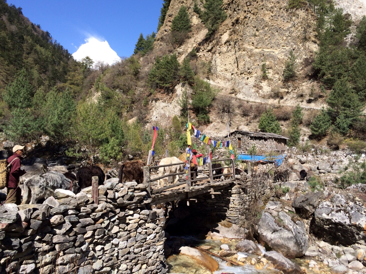
Jagat is a beautiful place with many beautiful things to explore in the evening. There are about 40 houses in this village and attractions such as Mani walls, Stupas, and traditional houses.
Day Activity Summary
The next day we begin our journey with breakfast at 7:00 A.M. in the tea house at Machha Khola. We will trek towards Khola Besi. We continue our hike for 45 minutes until we reach Khola Besi. Then again, we hike for 356 minutes until we reach Tatopani( natural hot spring ). At this place, you can soak your feet and enjoy its warmth. We trek towards Thulo Dhunga where we will have our lunch. After taking a rest for a while, we trek towards Jagat. This is a challenging stretch that takes 2.5 hours to reach. We stay overnight here at one of the tea houses in Jagat.
Difficulties during the Trek
- You may occasionally have to walk along the road on the first two days, which can make the dust from the cars unpleasant.
- On the second day, you might come across a landslide, which is difficult, so pay attention to the instructions.
- It will be hot throughout the day because you are trekking on the lower trail, primarily in tropical regions
Day 03: Trek from Jagat to Deng (1860 m)
Day Summary
Trek Route: Jagat → Salleri → Philim → Chisapani → Deng
Beginning Point: Jagat (1340 m/ 4396 ft)
Ending Point: Deng (1860 m/ 6102 ft)
Lunch: Chisapani
Jagat to Deng Distance: 22 km (13.6 miles)
Total Descent: 520 m/ 1706 ft
Overnight: Deng
Meal: Breakfast, Lunch and Dinner
Accommodation: Tea House
Walking / Driving: 7-8 hours trekking
Tea house Information
Number of Tea houses: 4-5 teahouses
Room with attached bathroom: Not Available
Wi-Fi: Available
Charge in the room: Not Available
Deng
There are about 20 homes and four or five hotels in this tiny village. Due to its location directly on the riverbank, Deng offers a stunning view of a small peak.90% of the communities are Buddhist, and this little stupa has mani walls.
Day Activity Summary
Today we hike towards Deng. We start our journey from Jagat to Salleri which will take 1 hour along the river bank of Budhigandaki. The next destination is Phillim which will also take another 1 hour. Phillip is one of the most beautiful and the largest village. Again we hike toward the Chisapani. It will take 45 minutes to reach Chisapani from Phillim. We will have our lunch and take a rest for 1 hour. The final destination for today is Deng and is quite challenging. The trek will take almost four hours to reach Deng from Chisapani. We will pass by beautiful villages such as Nyak and Pewa along the way.
Day 04: Trek from Deng to Namrung (2630 m)
Trek Summary
Trek Route: Deng → Bhee Phedi → Ghap → Namrung
Beginning Point: Deng (1860 m/ 6102 ft)
Ending Point: Namrung (2630 m/ 8628 ft)
Lunch: Ghap
Deng to Namrung Distance: 19 km (13.4 miles)
Total Descent: 770 m/ 2526 ft
Overnight: Namrung
Meal: Breakfast, Lunch and Dinner
Accommodation: Tea House
Walking / Driving: 6-7 hours trekking
Tea House Information
Number of Tea House: 4-5
Room with Attached Bathroom: Not Available
Wi-fi: Available
Room Charger: Available
Namrung
Namrung is another lovely village with interesting sites to see, including a police station, a small school, 15 nearby villages, and Gomba. Most of the locals are Buddhists who came from Tibet.
Day Activity Summary
Today we trek for long hours from 8 am to 3 pm. Firstly, we trek towards Deng to Bhee Phedi. This one is a challenging section as you have to ascend uphill. Once you reach Bhee Phedi you will witness beautiful villages, mountain peaks, gumbas, and Mani Walls. After crossing Bhee Phedi, we trek towards Ghap passing through dense forests. We will take a short break for one hour. Then, we trek towards Namrung which will take two hours. The journey is easy along the side of Budi Gandaki. We will be staying overnight at Namrung.
Day 05: Trek from Namrung to Shyala Village (3500 m)
Trek Summary
Trek Route: Namrung → Shoo → Loo → Shyala
Beginning Point: Namrung (2630 m/ 8628 ft)
Ending Point: Shyala (3500 m/ 11483 ft)
Namrung to Shyala Distance: 16.5 km (11.8 miles)
Lunch: At Loo
Total Descent: 870 m/ 2854 ft
Overnight: Shyala
Meal: Breakfast, Lunch and Dinner
Accommodation: Tea House
Walking / Driving: 4-5 hours trekking
Tea House Information
Number of Tea House: 10 Big teahouses+ few homestays
Attached bathroom: Might find a few
Wi-Fi: Available
Charging in the room: Available
Shyala
Shyala provides one of the best views of Manaslu and other mountains, including Himchuli and Nadi Chuli, and features a pleasant monastery, stupa, mani wall, school, and health center. Additionally, there are fifty Buddhist homes in the area.
Day Activity Summary
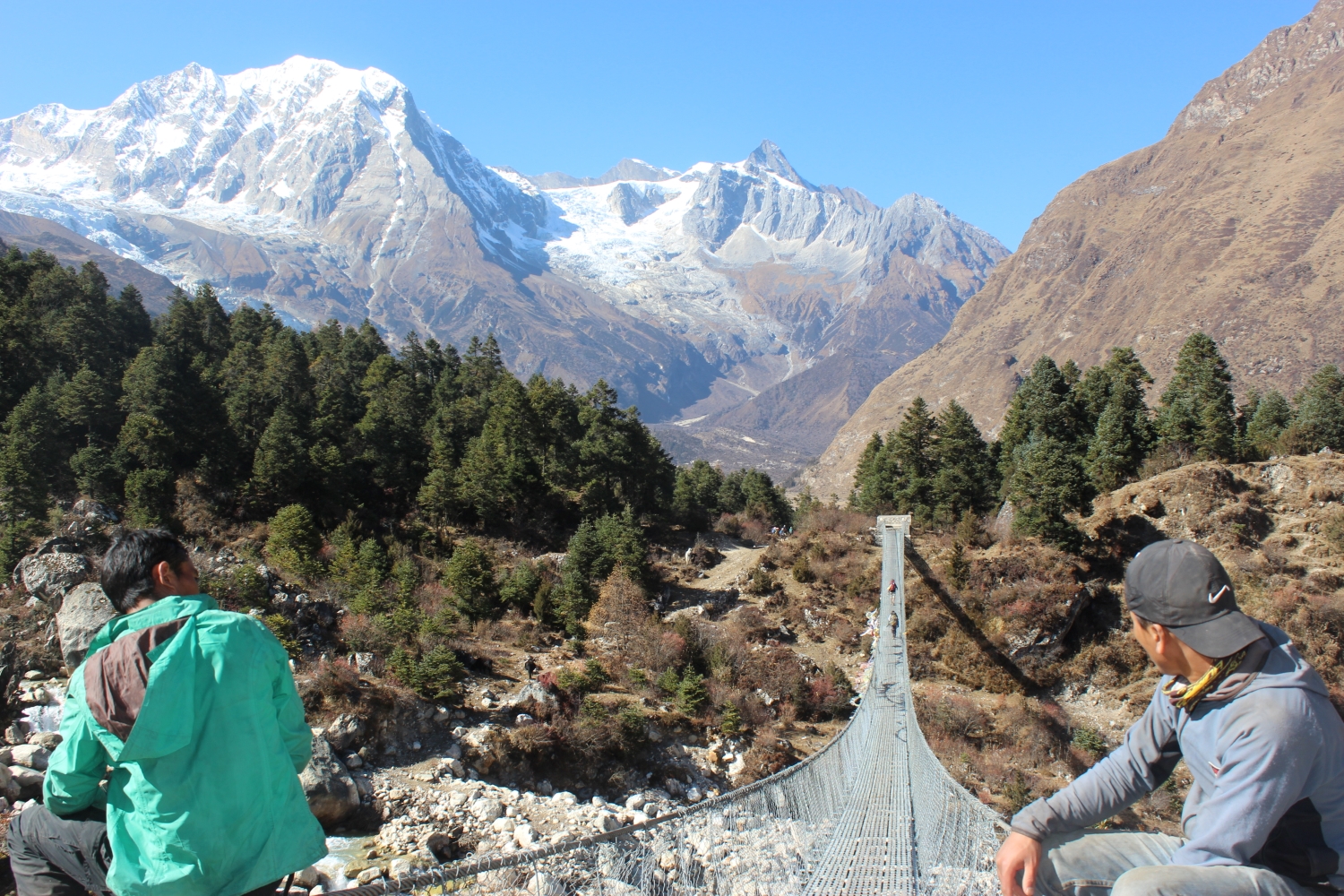
Today is a short and interesting hike. We hike from Narmung to Shoo.The trek's first two hours are spent on a level terrain. Suspension bridges and views of peaks, including Lamjung Himal on the left and Niki Peak on the right are seen.
After hiking for another two hours we reach the loo. Along the trail, you will start witnessing stunning Manaslu I and Himchuli. Again, we hike until we reach our final destination Shyala. The trail is filled with beautiful forest, rhododendron, and Juniper.
Day 06: Trek from Shyala to Samagaon (3530 meters) via Pyungen Monastery
Trek Summary
Trek Route: Shyala → Pyungen Gompa → Samagaon
Beginning Point: Shyala (3500 m/ 11483 ft)
Ending Point: Samagaon (3530 m/ 11581 ft)
Lunch: Samagaon
Shyala to Samagaon Distance: 17 km (10.6 miles)
Total Ascent: 539 m/ 98 ft
Overnight: Samagaon
Meal: Breakfast, Lunch and Dinner
Accommodation: Tea House
Walking / Driving: 4-5 hours trekking
Tea House Information
Number of tea houses- 10- 12 tea houses + homestay
Attached bathroom: Available
WiFi: Available
Charging plugs in the room: Not Available
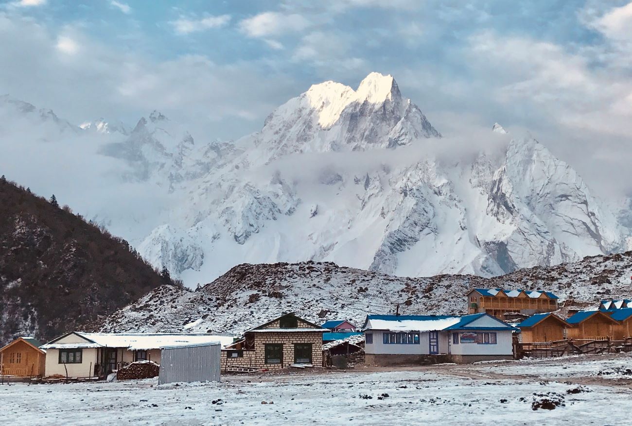
Samagaon
Samagaon is the biggest and most fascinating settlement. The village, which is also the center of the local market, is the ideal location for two days of acclimatization because it has a school, a health post, a check post, and one historic monastery.
Day Activity Summary
The journey starts at 8:00 Am from Syala, moving towards Pyungen Gompa. The 1.5-hour trek is quite challenging. Pyungen Gompa is a 600-700-year-old monastery that offers stunning views of the Manaslu range. Then we descend towards Samagaon for 2.5 hours. Usually, all the trekkers arrive between 2:00 and 3:00 P.M.
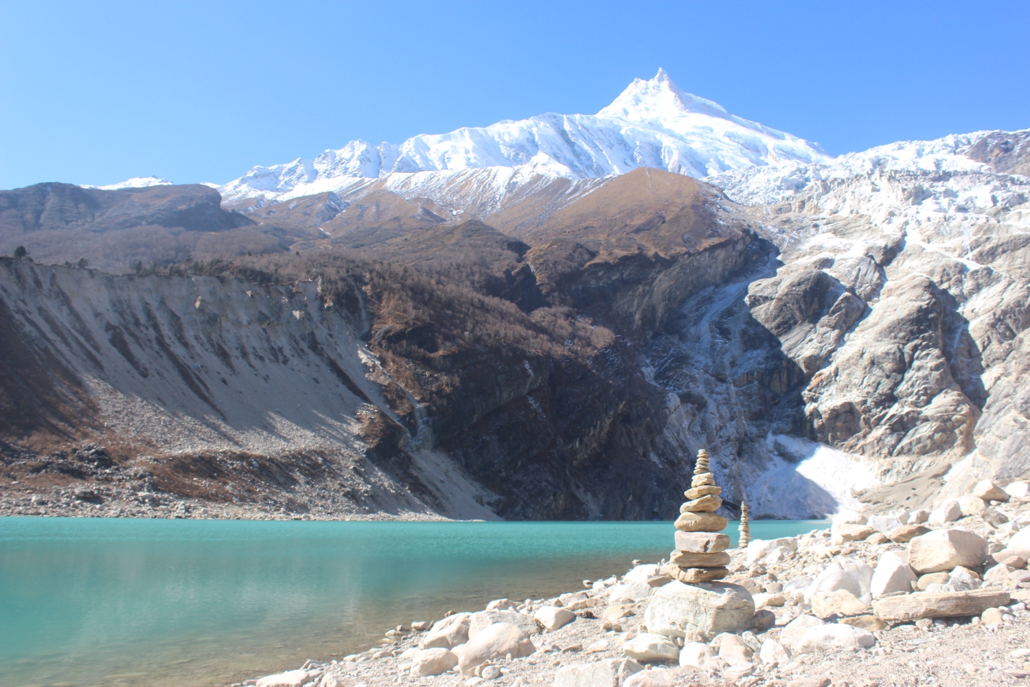
Day 07: Rest Day at Samagaon – Side Trip to Manaslu Base Camp
Trek Summary
Trek Route: Samagaon → Birendra Lake/ Manaslu Base Camp
Beginning Point: Samagaon (3530 m/ 11581 ft)
Ending Point: Samagaon (3530 m/ 11581 ft)
Lunch: Packed Lunch
Samagaon to Manaslu Base Camp Distance: 13.2 km (8.2 miles) (round trip)
Total Ascent: 1270 m/ 4166 ft
Overnight: Samagaon
Meal: Breakfast, Lunch and Dinner
Accommodation: Tea House
Walking / Driving: 7-8 hours trek (round trip)
Day Activity Summary
Samagaon is perfect for the rest day and acclimatization which offers two hiking options. If you want an easy option then choose Birendra Lake. It is a serene glacier reached by only 1-hour uphill hike. If you want more fun and adventure then go for 4-5 hours of trek to Manaslu Base Camp. It provides stunning views of the mountain's foothills.
Day 08: Trek from Samagaon to Samdo (3875 m)
Trek Summary
Trek Route: Samagaon → Samdo
Beginning Point: Samagaon (3530 m/ 11581 ft)
Ending Point: Samdo (3875 m/ 12713 ft)
Lunch: Samdo
Samagaon to Samdo Distance: 9.1 km (5.7 miles)
Total Descent: 345 m/ 1131 ft
Overnight: Samdo
Meal: Breakfast, Lunch and Dinner
Accommodation: Tea House
Walking / Driving: 6-7 hours trekking
Tea House Information
Number of Tea houses: 6-7 teahouses
Attached bathrooms: Available
Wi-Fi: Available
In-room plug: Not Available
Hot shower: Available
Samdo
Samdo, commonly known as the forbidden village, is the very last village of Manaslu. The residents of this sizable village, which has between thirty and forty local homes, are all Buddhists.
There are stupas and monasteries as well. You can see the entire Manaslu range and the stunning Samdo peak directly from the hotel window.
Day Activity
The trek from Samagaon to Samdo is about 4 hours. You will come across the alpine meadows with no villages in between. You will only find a few huts and suspension bridges. After crossing the Budhi Gandaki River and arriving at the settlement, where you will have lunch, the largely level trail culminates in an ascent to Samdo.
Day 09: Rest Day at Samdo – Side Trip to Tibetan Border
Trek Summary
Trek Route: Samdo → Tibetan Border → Samdo
Beginning Point: Samdo (3875 m/ 12713 ft)
Ending Point: Samdo (3875 m/ 12713 ft)
Lunch: Packed Lunch
Samdo to Tibetan Border Distance: 19.5 km (12.1 miles) (round trip)
Total Ascent: 940 m/ 3083 ft
Overnight: Samdo
Meal: Breakfast, Lunch and Dinner
Accommodation: Tea House
Walking / Driving: 8-9 hours trekking (round trip)
Day Activity Summary
An extra rest day Samdo has two side trip options for you. For a longer adventure, you can go for Tibetan Pillar. The Tibetan pillar can be reached after a 5- to 6-hour climb to the Tibetan border, which offers breathtaking views and acclimatization. A less demanding approach to take in stunning views is to go uphill for two hours to reach Samdo Peak. Both choices provide time for leisure and photography.
Day 10: Trek from Samdo to Dharamasala (4460 m)
Trek Summary
Trek Route: Samdo → Larkya Bazar → Dharmasala
Beginning Point: Samdo (3875 m/ 12713 ft)
Ending Point: Dharmasala (4460 m/ 14633 ft)
Lunch: Dharmasala
Samdo to Dharmasala Distance: 6.1 km ( 3.8 miles)
Total Ascent: 585 m/ 1919 ft
Overnight: Dharmasala
Meal: Breakfast, Lunch and Dinner
Accommodation: Tea House
Walking / Driving: 2-3 hours trekking
Tea House Information
Number of Tea houses: 3
Attached Bathroom: Not Available
Wi-Fi: Available
Charing in room: Not Available
Dharamshala
The most remote stop on the road is Dharmashala, which has just three hotels and no community. You may be forced to sleep on a mat in the common area due to the extremely inadequate accommodations. Most visitors also hike to Khaki Danda for a few hours to get acclimated.
Day Activity Summary
The brief 4.5-hour hike to Dharamsala on the tenth day of the Manaslu Circuit is difficult because of its secluded location. The trail climbs 500m through alpine meadows with views of the Larkya Glacier after starting from Samdo and hiking for 30 minutes to Larke Bazaar, where it crosses a wooden bridge over the Budhi Gandaki River. A stone-built guest house awaits you when you get to Dharamsala by 1 PM, where you can rest and have lunch. A detour to the Tibetan border is another function of Larke Bazaar.
Day 11: Trek from Dharamasala to Bhimtang (3590m) via Larke Pass (5106m)
Trek Summary
Trek Route: Dharmasala → Larkye La Pass → Larke Phedi → Dovan → Bhimthang
Beginning Point: Dharmasala (4460m/ 14633ft)
Ending Point: Bhimthang (3590m/ 11778ft)
Lunch: Larke Phedi
Dharmasala to Bhimthang Distance: 16 km (9.9 miles)
Total Descent: 870m/ 2854ft
Overnight: Bhimthang
Meal: Breakfast, Lunch and Dinner
Accommodation: Tea House
Walking / Driving: 8 hours trekking
Tea House Information
Number of tea houses: 6- 7 teahouses
Attached Bathroom: Not Available
Wi-Fi: Available
Charing in room: Not Available
Bhimtang
The only place for travelers to stop is Bhimtnag, Manaslu, Punker Himal, and Lamjung Himal are visible from the backside
 .
.Day Activity Summary
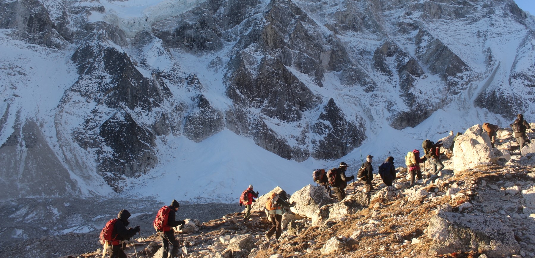
The hardest day of the Manaslu Circuit trip starts at 4:00 AM and lasts for eight hours, covering more than 16 km. The 704-meter hike to Larke Pass, which begins in Dharamsala, offers breathtaking views of frozen lakes and peaks including Himlung Himal, Cheo Himal, Kang Guru, and Annapurna II. A 2.5-hour descent leads to Larke Phedi, where you can have lunch, after arriving at the pass by 9 or 10 AM. An exhausting but worthwhile day concludes when you reach Bhimtang, which is usually reached around 2-3 PM after the final 1.5-hour hike.
Day 12: Trek from Bhimtang to Tilje Village (2300 m)
Trek Summary
Trek Route: Bhimthang → Yak Kharka → Sokhe → Goa → Tilje
Beginning Point: Bhimthang (3590 m/ 11778 ft)
Ending Point: Tilje (2300 m/ 7546 ft)
Lunch: Goa
Bhimthang to Tilje Distance: 20 km (12.4 miles)
Total Descent: 1290 m/ 4232 ft
Overnight: Tijle
Meal: Breakfast, Lunch and Dinner
Accommodation: Tea House
Walking / Driving: 5-6 hours trekking
Tea House Information
Number of tea houses: 4-5 Teahouse
Attached Bathroom: Available
Wifi: Available
Charing in room: Available
Tilje
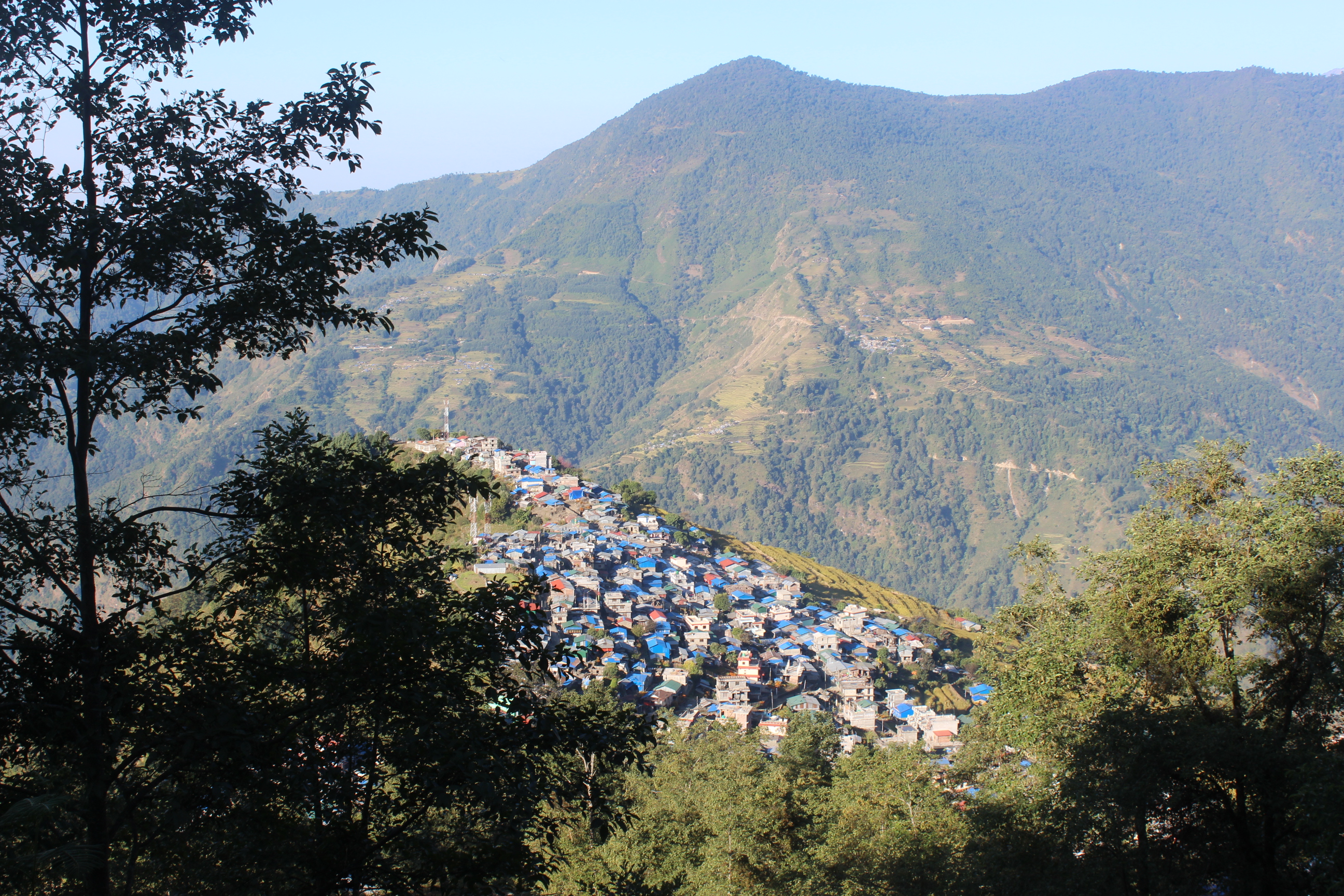
The final village on the Manaslu hiking route is Tilje. Around 3 p.m., we arrive here and get ready for the drive to Kathmandu the following day. There are 30 to 40 homes in Tilje village for both Hindus and Buddhists. It also has a health post and a gompa.
Day Activity Summary
We start our journey from Bhimthang for a 2.5-hour hike that leads to Yak Kharka. Then again we trek for 2 hours to Sokhe and continue to Goa. We will take a break around 1 pm. The day concludes with a peaceful 2-hour walk through the forest. villages after reaching Tilje.
Day 13: Drive back to Kathmandu (1400 m) from Tilje
Drive Route: Tilje → Beshisahar → Dhading → Kathmandu
Beginning Point: Tilje (2300 m/ 7546 ft)
Ending Point: Kathmandu (1400 m/ 4600 ft)
Lunch: En Route
Tilje to Kathmandu Distance: 200 km (124.3 miles)
Total Descent: 900 m/ 2952 ft
Overnight: Pokhara/ Kathmandu
Meal: Breakfast and Lunch
Accommodation: Not Included
Walking / Driving: 8-9 hours driving
Meal: Breakfast and Lunch
Accommodation: Not Included
Walking / Driving: 8-9 hours driving
Day Activity
This is the day to say goodbye to the Himalayas. Utilize your last few minutes to share your experiences in the Himalayas with any locals. From Tilje, we join a local jeep at around 8/8:30 in the morning. The jeep ride from Tilje to Besishar is off-road, and we get to Besisahar at 12/1 am. This is about 45 to 45 km of ride only. After this, we head towards Kathmandu which is a 170 Km long journey reflecting our refreshing journey. Apart from this trek, you might like the Manaslu Circuit Trek.